 |
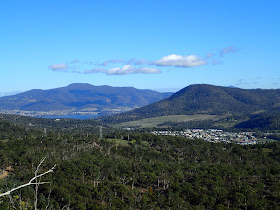
| Summit of first Eagle Hill |
I parked at the start of Geilston Creek Road or the walk could also be started on the corner of Fairfield and Geilston Creek Roads where there is parking. There is no parking at the end of Geilston Creek Road. The path is initially a gravel road, then pathway, then sealed road before entering the reserve. After that it is mainly on old roads and tracks and bike tracks.
I headed up to Rocky Tom and Caves Hill first on various tracks. It was all easy walking. I had a wander around the cliffs both on top and below and checked out some of the caves.
 |
| Top of Caves Hill |
 |
| Quarry and Flagstaff Gully Reservoir |
I then headed over to Flagstaff Hill where there were more great views over Hobart.
From here I walked in the direction of Eagle Hill. What was once an old vehicle track and some off track walking has now become a bike track which provides good walking. The bike track heads down to the base of the first hill of Eagle Hill before changing direction and leading back downhill to join the rest of the bike tracks. I walked straight up the first summit of Eagle Hill where there were great views and then down and across the saddle to summit two. The views were also good from here.
 |
| Midway Point |
 |
| Bike Track |
 |
| First Eagle Hill |
 |
| First Eagle Hill Summit |
 |
| Hobart |
 |
| Second Eagle Hill Summit |
This was a really good little walk on a very pleasant day and all quite easy walking.
Distance: 12.4 kms.
Time: 4'11"
Ascent: 645 metres
GPX file is here.


No comments:
Post a Comment