Sunday 10th November 2013
 |
| Cataract Falls |
This was to be an exploratory walk as I had no information on Cataract Falls regarding access, terrain and scrub and what the falls were actually like.
I drove out to the end of Van Morey Road near Margate and parked in a small car park beside the road. The road is deteriorating somewhat and 4WD is really required to reach the spot where I parked, although it is possible to park further back down the road and walk a bit further. The starting point for this walk was the same as I previously used when I walked to Grey Mountain and also the top of Pelverata Falls.
It was almost 0800 when I set off walking. The first 1.6 kms. was on the main track through Snug Tiers and this was a little wet in places, but the pools where easily negotiated. After this I turned left and headed down a disused track which was leading in a southerly direction. It was not long before I came upon a large puddle which I was only able to cross by taking a flying leap and landing on the other side - I need not have bothered as a little further on was this enormous puddle which I could not get around. So, if I was to do the walk, then wet feet it was going to be. This was the norm for this part of the track as I forded many such large pools of water. The water was cold and up to my knees in a couple of places, but once my boots were wet, I did not care anymore.
 |
| Waterlogged section of track |
This went on like this for nearly 2 kms. until I reached a junction where I turned left and followed this overgrown track until I came to another junction before turning and heading east. Along this part of the track were some views of the Derwent estuary.
After about 1 km. I came to the place where I thought would be a good spot to head off track towards the falls, and after walking only a few metres came across an old track. When I say track, it was barely visible in the low scrub, but it did make progress a little easier. This finally petered out and I was confronted by dense scrub which I just had to battle through, if I was going to reach the falls. It probably only lasted for about 100 metres or so, but it took me ages to get through it. Once I broke through I was on the top of the slope heading down to the Snug River. My aim was to climb down to the bottom of the falls and the back up to the top of the falls and back out.
 |
| Rock Formation |
The descent into the creek was very steep, with lots of downed trees and soft soil to contend with.
There were also some interesting large rock formations and evidence of past logging with huge tree stumps remaining. Anyway, with what seemed like along time going down, I finally reached the base of the falls, and I was not disappointed. The falls were spectacular, with lots of water cascading over. Climbing up the actual falls was not possible due to the amount of flow and the slippery rocks, so I opted to climb back up to the elevation that I expected the top of the falls to be and then proceeded to walk across the slope. Once I reached a point where I thought the top should be I had to descend slightly and came out on a large rock overlooking the top of the falls. Another great view.
It was then just a matter of climbing back up the steep slope and retracing my steps to the car, with a slight detour on the way via another track. It was along this track that I discovered some old machinery just off the track. I stopped for lunch beside a small creek on the way back and finally reached the car at 1445.
Overall an enjoyable walk despite the water, mud, scrub bashing and steep slopes as the falls were great.
Distance: 14.6 kms.
Time: 6'43"
Ascent: 500 metres
Click here to download GPX track.
 |
| Morrison Hill |
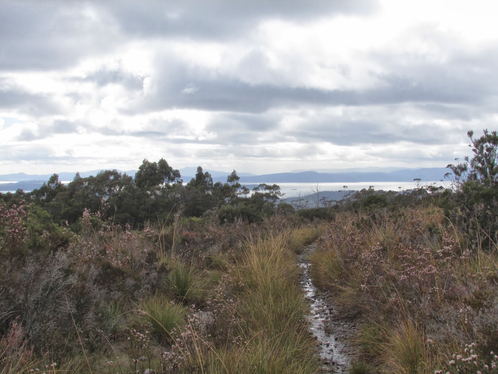
 |
| Derwent Estuary |
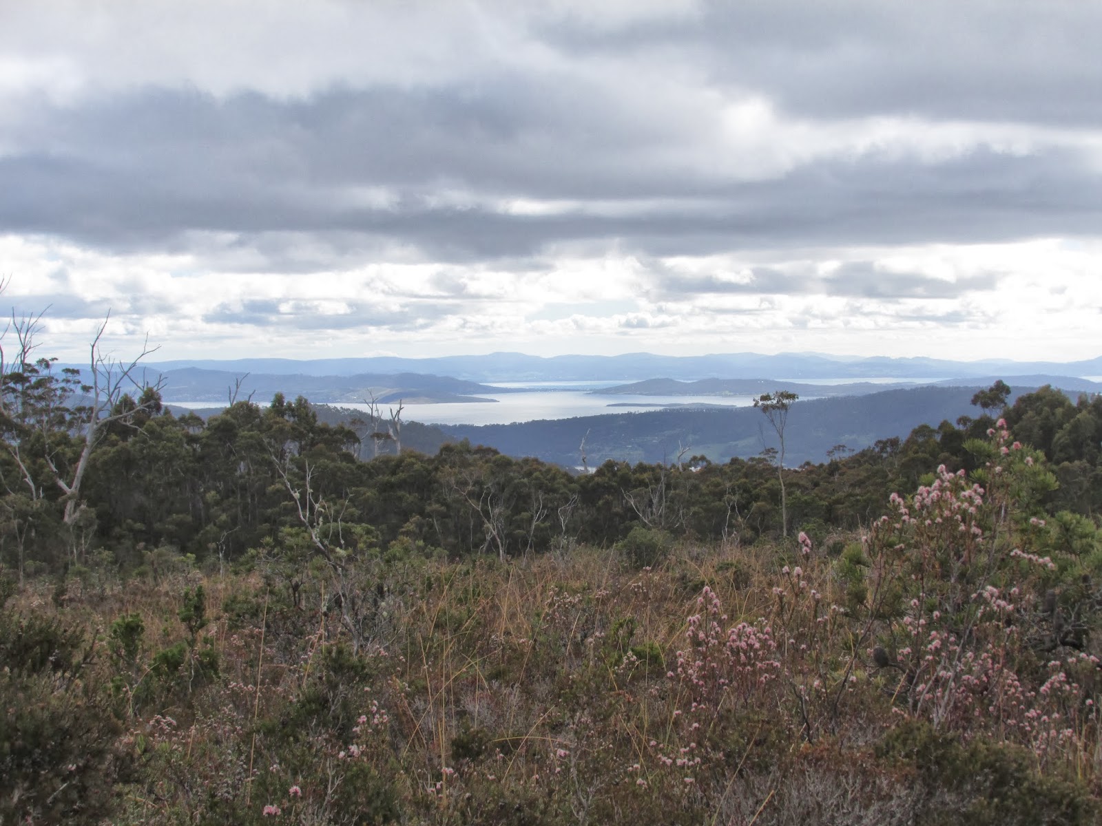
 |
| Derwent Estuary |
 |
| Bottom of Cataract Falls |
 |
| Top of Cataract Falls |
 |
| Top Cataract Falls |
 |
| Old Logging Stump |
 |
| Abandoned Machinery |
 |
| Abandoned Machinery |