Thursday 24th May 2018
 |
| Kermandie Falls |
I had been to Kermandie Falls a couple of times previously but wanted to tackle it from a different starting point at the end of Bennetts Spur 1/3. This is a forestry spur off Bennetts Road which in turn is off Arve Road from Geeveston. The drive to the start point was quite straight forward and I parked at the end of the spur.
An old track headed off from here down to the Kermandie River and was easy to follow as it was flagged all the way. The river was easily crossed and once that was achieved I was on the Old Hartz Track.
 |
| Start of track |
 |
| Track down near the river |
 |
| Kermandie River |
The Old Hartz Track was in its usual condition with many trees large and small across it which slowed progress somewhat.
 |
| Old Hartz Track |
 |
| Old Railway Cutting |
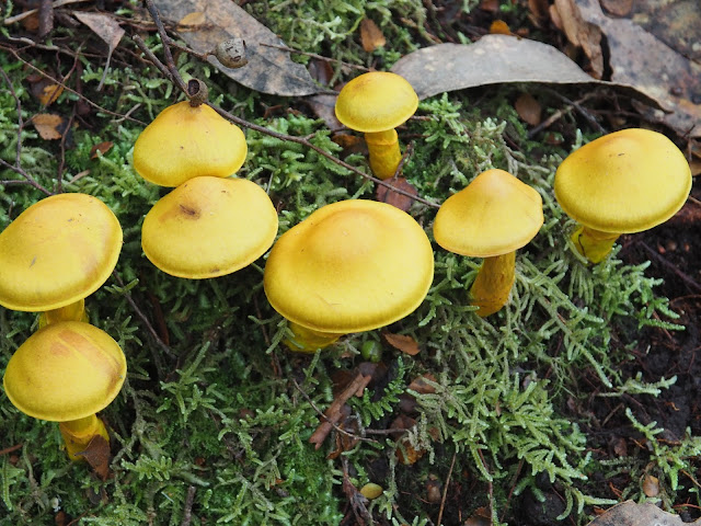
There were lots and lots of different kinds of fungi around and I photographed a few of them.
The falls were flowing well and I stopped for a short time for some shots before heading out to Riawunna Road to find a dry spot to have something to eat.
 |
| Kermandie Falls |
 |
| Cascade below the falls |
I walked up Riawunna Road a short distance to see what it was like and it seemed quite reasonable but I was not sure that I could get back to the track that way so returned to the Hartz Track and walked back up to the old railway line. From here there was a marked track down to Riawunna Road so it would have been possible to walk up it and get back on the Hartz Track. Next time. From here it was just an easy amble back to the car.
This was a good walk to the falls. It was a bit longer both in time and distance than the traditional way but that was okay.
Distance: 10.8 kms.
Time: 4'48"
Ascent: 380 metres
Click here to download GPX file.


