Pages

Friday 24 August 2018

Eagle Hill

Friday 24th August 2018

Summit of first Eagle Hill
Today's walk was mainly to check out some more tracks in the Meehan Range area including around Rocky Tom, Caves Hill, Flagstaff Hill and to end up at Eagle hill as a destination point. It all went to plan on a gorgeous winter/spring day.
I parked at the start of Geilston Creek Road or the walk could also be started on the corner of Fairfield and Geilston Creek Roads where there is parking. There is no parking at the end of Geilston Creek Road. The path is initially a gravel road, then pathway, then sealed road before entering the reserve. After that it is mainly on old roads and tracks and bike tracks.
I headed up to Rocky Tom and Caves Hill first on various tracks. It was all easy walking. I had a wander around the cliffs both on top and below and checked out some of the caves.


Top of Caves Hill

Quarry and Flagstaff Gully Reservoir

I then headed over to Flagstaff Hill where there were more great views over Hobart.


From here I walked in the direction of Eagle Hill. What was once an old vehicle track and some off track walking has now become a bike track which provides good walking. The bike track heads down to the base of the first hill of Eagle Hill before changing direction and leading back downhill to join the rest of the bike tracks. I walked straight up the first summit of Eagle Hill where there were great views and then down and across the saddle to summit two. The views were also good from here.
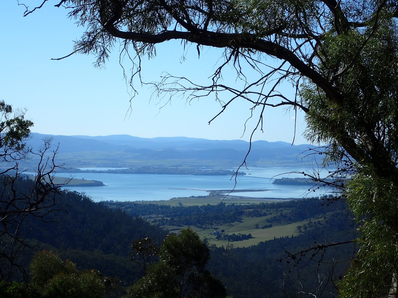
Midway Point

Bike Track

First Eagle Hill

First Eagle Hill Summit

Hobart

Second Eagle Hill Summit
From the second summit I walked back down and around the western side of Rocky Tom before following various tracks back to the car. One section of bike track that I walked on the western side of Faggs Gully Creek was very pleasant walking through nice bush.
This was a really good little walk on a very pleasant day and all quite easy walking.
Distance: 12.4 kms.
Time: 4'11"
Ascent: 645 metres
GPX file is here.


Saturday 11 August 2018

Huon Point

Saturday 11th August 2018

Huon Point
I was not sure about this walk as I could find no information on it so I just decided to have a go at it and to see what happened. The aim was to walk from Big Roaring Bay Beach along the coastal reserve to Surveyors Point and then back along the road to the car.
I parked at the car park at Big Roaring Bay Beach and set off in a westerly direction to the end of the sand and where the small lagoon flows to the sea.


Western end Big Roaring Bay Beach

Lagoon

Big Roaring Bay Beach
I then turned around and walk in an easterly direction along the beach to the rocks at the end. I could see what appeared to be something on sticks and I thought they must have been some sought of navigation aid, but as I got closer I could make out that they were sea eagle sculptures.

Eastern end Big Roaring Bay Beach

Big Roaring Bay Beach


Heading around to Huon Point
I continued on to Huon Point but was prevented from continuing on around the rocks due to the depth of water. There was no other way but up and over. It was a steep climb over some loose scree to reach the top, but once there it was fairly easy walking from then on.

Impassible Huon Point

Big Roaring Bay Beach from the top of Huon Point
I continued walking north along the coast, all the while staying in the coastal reserve. In some places I was able to walk along some rocky little beaches but most of the time I was up above the water on the higher ground.


Soon I reached Surveyors Bay and it's rather quaint cottages right on the beach.

Sea Caves Surveyors Bay

Surveyors Bay

Surveyors Bay
At the end of Surveyors Bay was a track that led up and over Surveyors Point. It was a relatively good track when compared to where I had been walking. I continued on heading north for a short distance before finding a spot for lunch.


After lunch I walked back to Surveyors Bay and then along Surveyors Bay and Esperance Coast Roads to the car.

From Esperance Coast Road
This was a good little short walk with nice views of the Huon River on an overcast day.
Distance: 8.5 kms.
Time: 3'23"
Ascent: 310 metres
GPX file is here.