Pages

Tuesday 29 March 2016

North West Bay River

Monday 28th March 2016

North West Bay River
Today was to be a mixture of places I had been before and some new areas. It was basically a loop walk incorporating Dead Island, some of the South Wellington Plateau and a section of the North West Bay River. I borrowed some of the walk from Peter Franklin's Blog.
I set off early, just on daybreak, from the large car park uphill from Big Bend and walked across the moor to Dead Island. It was quite cold and windy, but tolerable, and the moor was wet as usual but not too bad as I managed to get across with dry boots.

Sunrise over Hobart

Sun just hitting Thark Ridge

Dead Island in the gloom

Dead Island
Dead Island is not dead at all and is covered with plenty of vegetation, although it is easy walking.
I crossed the Island and headed up the ridge to the top and along to the southern end. There was some minor scrub before the ascent but it was not a problem.

Scree field on the ascent

On the ascent

Dead Island from top of ridge

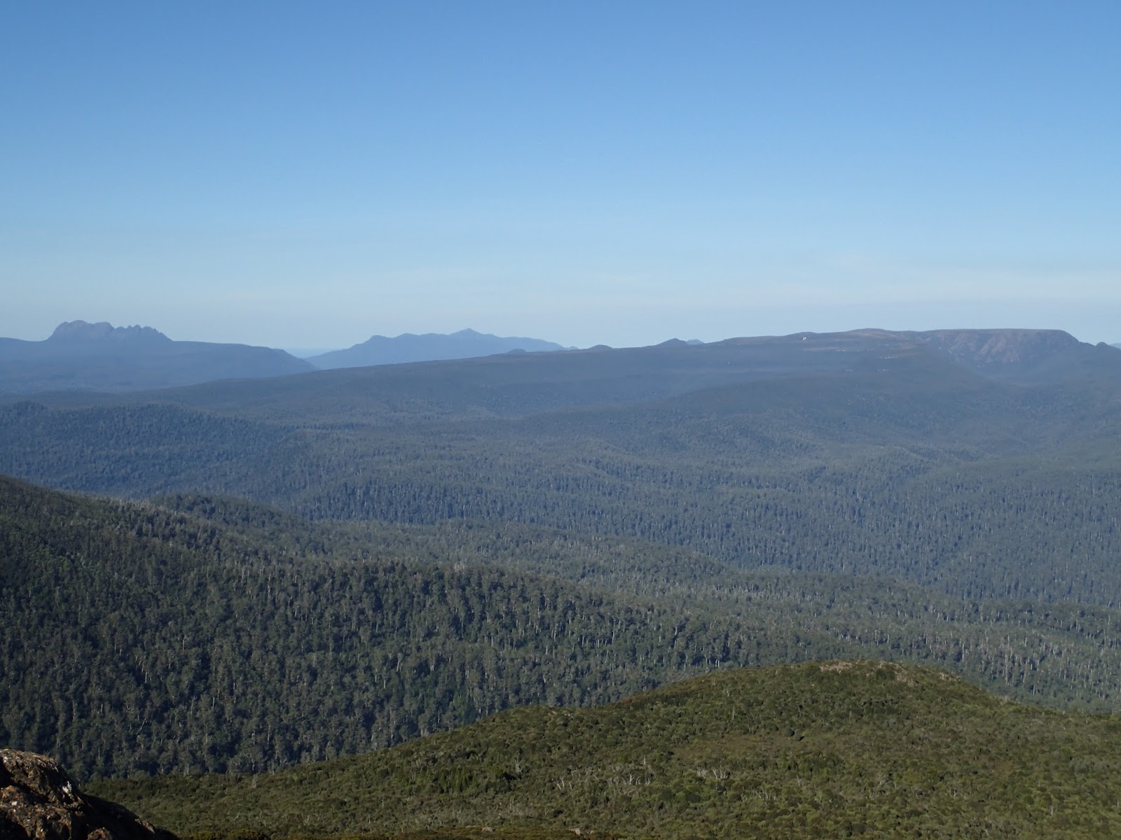
Thark Ridge from top of ridge

Top of ridge

Top of ridge
At the southern end of the ridge I simply continued to follow it down heading slightly to the right of Mount Montagu. It was quite rocky in places but all manageable.

Cathedral Rock and Montagu Thumbs

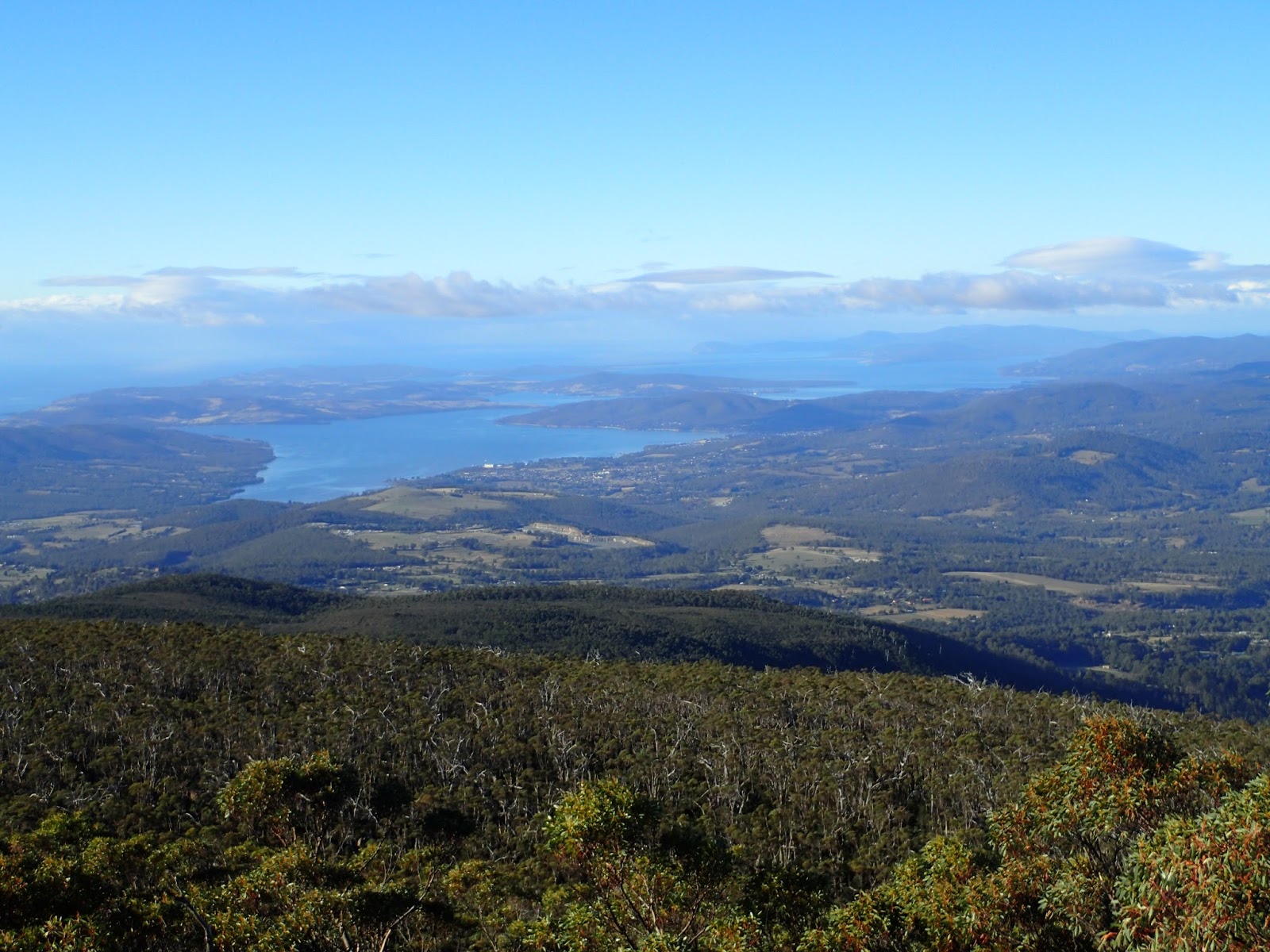
Looking towards the Derwent
When I reached the end of the rocky descent the scrub did thicken up quite considerably and required some effort to get through, but I finally arrived at the North West Bay River where I stopped for a well earned break. There was a reasonable flow for this time of year.

Where I reached the river

Where I reached the river
After the break I rock hopped upstream to where the first boulder field became visible. Along the way were some small cataracts which were quite pretty.


I left the river here and followed scree fields where they existed and minor scrub to eventually reach the Thark Ridge track. From here it was an easy ramble back to the car.
This was a good walk and the majority was off track. I would suggest that if rock hopping is not your thing, then it would be advisable not to do this walk, as there is plenty of it.
Distance: 8.8 kms.
Time: 5'45"
Ascent: 360 metres
Click here to download GPX file.


Thursday 17 March 2016

Devils Backbone

Thursday 17th March 2016

Devils Backbone,Hartz Peak and Mount Snowy
Sometimes walks don't go as planned and today was one of those. I had planned to walk from Hartz Mountains car park to Lake Perry, up to Devils Backbone along the ridge and back via the Hartz Peak track. It did not turn out quite like that as I had to cut the walk short.
I was the first car at the car park and set off up to Lake Osborne and then to Lake Perry. It was quite easy walking up until this point and a bit further up the ridge that headed up to Devils Backbone was okay as well with a pad to follow.
Lake Osborne

Lake Perry

Lake Perry
Soon the pad petered out or I failed to locate it, so I just went straight up towards the summit of the Backbone ridge. The scrub was quite bad in places and required some effort to break through, but eventually I came out on to the ridge line and walked up to the summit cairn on the right, about 200 metres from where I reached the top. This was very easy walking along here.
Northern section of Backbone

From Summit

Lake Perry from Summit

Looking towards northern section

From Summit

Summit Cairn
I then headed off along the ridge back towards Hartz Peak. There was a faint pad to follow and much was easy walking but there were a few scrubby sections and a few hills to climb. All was going well until I reached about the halfway point and I stepped in a hole with one foot and consequently smashed my knee on the other leg into a large rock. After initially recovering from the pain, I tried the knee out and it was a bit dicky, so rather than stress it out too much more, I decided to head down off the ridge to the Lake Osborne boardwalk, which I could see in the distance.
One of the rocky hills along the way

Looking towards Hartz Peak

The boardwalk in the distance
This proved to be a good move because I found a great rock on which to stop and have lunch and rest up my knee. The descent to the boardwalk was a little scrubby in places but it did no take me too long to get down. after that it was just an amble or maybe that is hobble back to the car. The car park was full to overflowing and there were people everywhere.
This was a good walk(what I did of it anyway) and there is great scenery all along the Backbone on a clear day.
Distance: 6.4 kms.
Time: 5'04"
Ascent: 355 metres
Click here to download GPX file.


Thursday 3 March 2016

Montagu Trails

Thursday 3rd March 2016

Montagu Thumbs
Thanks to Rambo for this route which I obtained from Share My Routes. The walk turned out pretty much as he described it and I chose to do it in an anticlockwise direction.
I started off from the car park in Betts Road and walked up the steep zig zag fire trail and then up to Cathedral Rock. It was a very clear day and an ideal temperature. It took me about 2 hours to reach here.
From Cathedral Rock

From Cathedral Rock

From Cathedral Rock
I stayed for a few minutes and then headed along the ridge line to Montagu Thumbs.
From Montagu Thumbs Ridge

From Montagu Thumbs Lookout

From Montagu Thumbs Lookout

From Montagu Thumbs Lookout

From the summit Montagu Thumbs
I stopped at the lookout and then carried on over to the high point and then down to the Montagu Fire Trail and down to Norris Hut. I had been here before but it always good to have another look. I climbed up on the large rock at the back of the hut and took a few photos.
Norris Hut

Norris Hut

Norris Hut

Prominent Rock above Norris Hut

View from Rock behind Norris Hut

Norris Hut from above
After this I continued walking down the fire trail which was steep and very rocky in places. I was thinking to myself that "I hope the track going across to Cathedral Rock is not badly overgrown as I would hate to have to walk back up this hill". I need not have worried because when I reached the turnoff, I found it to be in quite reasonable condition. It was about the width of an ATV but I don't know its history. This track passed through some very nice forest in places and was pleasant walking.
Nice forest

The track

The track
When I neared Grundys Creek I had to cut across to an old track which eventually intersected the fire trail that heads up to Cathedral Rock. It was mostly flat walking up to the Cathedral Rock turnoff and then steeply downhill and back to the car.
This was a good walk and the rain forest area was worth seeing but I found it quite tiring due to a fair bit of up.
Distance:17.3 kms.
Time: 7'35"
Ascent: 1208 metres
Click here to download GPX file.