Pages

Saturday 25 July 2015

Platform Peak

Saturday 25th July 2015

Platform Peak Summit
Today I took some friends up to Platform Peak because they had not been there before. See previous post here for walk description and map.
We set off from the end of Braslins Road and walked up to the summit using the same route as I used last time. The weather was perfect with clear skies. To add a little variation, on the descent off the northern side of the peak, we followed an obscure track that branched right off the track. This eventually met up with an old track and finally the good road.
This was an excellent short walk with great views, although I didn't take very many photos this time.
It took an hour longer than when I did it solo.
Distance: 12.3 kms.
Time: 4"27"
Ascent: 509 metres
Click here to download GPX file.


Tuesday 21 July 2015

Weld Area Falls (Angel Falls)

Tuesday 21st July 2015

Angel Falls in the Weld Area
 There are four unnamed falls marked on the map in the Weld area and actually all are west of the Weld River itself. Today, I intended to attempt a walk to what I have called "Falls 1" (Angel Falls) and if that worked out on to "Falls 3". It did not quite turn out that way, but almost.
I parked at the start of the Reubans Falls track and set off. Now, most people would know that the bridge across Isabella Creek has been washed out for quite some time, so I scrambled around it on the right hand side and headed up the road.
End of the road

Washed out bridge
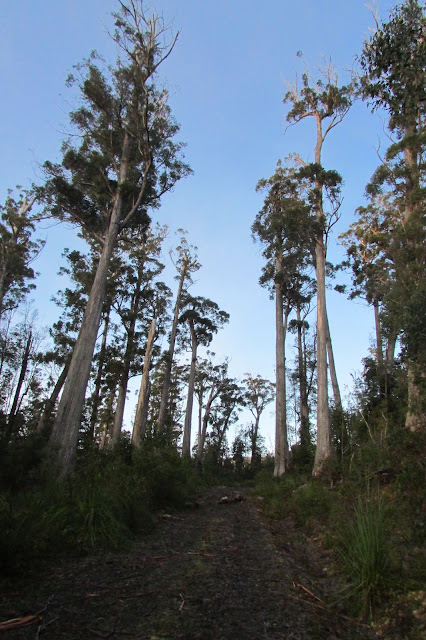
 About 1.3 kms. from the start I turned right on to a side road and walked to where it appeared to end. Along this section were some large trees that have escaped the chainsaw.


Unfortunately I obviously didn't have my eyes open properly, as I missed the start of the logging road I was looking for. I back tracked a short distance and headed into the scrub. Mistake 1. The scrub was very thick but I persevered and eventually hit the track that I had been searching for. The track was still very frosty and slippery because it consisted mainly of cut down trees. There was evidence of large trees that had been harvested.
Frosty Track

Remnants of large tree
 I continued on up the logging track until it ran out. By this stage it was all looking promising as I was only about 100 metres away from the falls. I did discover a few tapes which I followed down to the top of the falls. It was quite pretty here and I inched over to where the water goes over the edge. There appeared to be a reasonable drop, and, of course, I had to get down to the base of the falls.
Top of Angel Falls

Top of Angel Falls

Looking over the edge of Angel Falls
 Getting down to the base of the falls was not easy as it was very steep, slippery and muddy down towards the creek. I had to head for a point downstream and walk back up to below the falls. What a pleasant surprise. The falls were beautiful.  There was a good flow which generated a gentle breeze.
Angel Falls

Angel Falls

Angel Falls

Angel Falls

Angel Falls
 Afterwards I climbed back up and out along the track to the road, noting my mistake where I headed bush. Back up the road I turned right and followed a logging track for a distance before it ran out. Along here were huge stumps from timber harvesting.
This stump was huge - probably about 3 metres diameter at the base
 Now comes Mistake 2. I wanted to get over to the Mount Weld track and walk down to the creek which contained "Falls 3". Instead of walking back and following the road around, I opted to go straight across country to the track. I mean, how hard could it be. It was only about 120 metres. Well, the scrub was diabolical. It was so thick with low branches of trees going in all directions. But, being pigheaded I carried on and eventually burst out on to the track. It took me 25 minutes to travel that 120 metres!! Once on the track I walked down to the creek and checked out the access to the falls. It would have entailed a scrub bash upstream of about 400 metres which was something I thought I could do without. I will return in the future and walk upstream to the falls. From here I walked back to the car.
Marker for the start of Mount Weld track

This was a great walk and the falls were really worth the effort. I think they are worthy of a proper name. Of course it would have been so much easier without the mistakes. Never mind, it makes life interesting. The Mount Weld track was wet and muddy and had lots of cutting grass.
Distance: 8.4 kms.
Time: 4'42"
Ascent: 335 metres
Click here to download GPX file. 
Thanks to Nick Monk who provided the information on Weld Falls 1 that it was actually Angel Falls.

Thursday 16 July 2015

Judbury Conservation Area

Thursday 16th July 2015

Judbury Conservation Area
The Judbury Conservation Area is a small area just before Judbury on North Huon Road in the Huon Valley. I have driven past countless times and often wondered what was in there. Now I know.
I only wanted to do a short walk today, but because of the fog, I didn't get going until later on when the fog had lifted to some extent. It did not matter. Because the area is close to my place, I walked from home.
I did not have much of a plan as there did not appear to be any old tracks that would be useful, so I was expecting a bit of a scrub bash. I entered the Area near the south east boundary and started climbing.
A structure someone has built in the bush

Fire has been through at some stage

Climbing up after the initial scrub
The initial section was a little overgrown with light scrub and bracken, but not bad really, and once I attained some height the bush really opened up to become a lovely forest. I continued climbing and came to what appeared to be an old track and followed this up the ridge to a more open area which appeared to have been logged in the past.
Bush up higher

Evidence of past logging

Old track
I finally reached the north eastern boundary where there was a pine plantation and a very nice waterhole.
Approaching the pine plantation

Nice Waterhole

Forest Reflections
I walked along the boundary until I came to private property and then walked back and branched off  to walk around the start of a creek on to another ridge. This ridge consisted of quite open forest and was easy to walk along. The ridge descended very gradually and when I reached the point where it became steeper, I stopped for lunch. Here were views of Rimons and She Oak Hills.
Rimons Hill

She Oak Hills
From here I walked around another creek's origin before scrambling up to another ridge. This had better views and I could see the snow on the Snowy Range.
Rimons Hill again

Snowy Range
I kept descending on the ridge, availing myself of the numerous animal pads. The descent was reasonably steep in places but I eventually made it back to the road and walked home.
Glimpse of the Huon River through the trees
This was an enjoyable short walk. It was much better than I was expecting. I will return in the future to check out the bits I missed.
Distance: 4.6 kms.
Time: 2'39"
Ascent: 304 metres
Click here to download GPX file.


Saturday 11 July 2015

Gravelly Ridge

Friday 10th July 2015

Start of walk
I went out to Gravelly Ridge Conservation Area today and did some walking on some of the various tracks within the boundaries of the Area. I had never been there before so just made up a bit of a circuit using Google Earth. 
To reach the walk start I turned off at Colebrook into Rhyndaston Road, Eldon Road and Hungry Flats Road and drove to the beginning of the Conservation Area. The Area can also be accessed by driving up Brown Mountain Road and Hardings Road but there is more gravel this way. Either way can be accessed by 2WD vehicles.
First section of track
 I set off up Hardings Road for a short distance before finding the old track that I wanted. It had been blocked off from vehicle access by deep excavations. This track was followed for a short while before taking to the scrub and down and across a small creek and then steeply up a hill to a fire trail on top. I walked this trail for a while before heading up to Gravelly Ridge. The scrub on the hill climb was quite open and easily negotiated.
Small Creek

Looking Uphill

Looking Downhill

Open area on top of hill
This area recently burnt

Road on Gravelly Ridge.
 Now I don't particularly enjoy walking on formed roads but had to in this case to easily get to where I wanted to go. I walked along this road until I encountered a locked gate which was actually on Hardings Road. They have made massive excavations beside the road in both directions to prevent people bypassing the gate. It seemed to be working. From here it was up the road for 300 metres to another locked gate on the right. I walked around the gate and up the track for a short distance to locate an old overgrown track on the left leading up to the highest hill in the Area. There was a short climb to the summit where there were sandstone outcrops and limited views.
From Hill

Hill Summit

Hill Summit

Hill Summit

Hill Summit

Hill Summit

Hill Summit
Instead of retracing my path back down I scrubbed bashed down the south western side to once more pick up the track. The scrub was really not bad. Back on the track I followed this in a south westerly direction until it ran out. I was hoping for views here but, alas, no. After a short stop for lunch I walked back to the car, taking a few off track excursions, as walking in the bush was just as easy as on the track because it was so open. I did catch fleeting glimpses of Brown Mountain as I walked along a ridge line.
This was a good easy walk which provided one the opportunity to stretch the legs somewhat. I enjoyed the openness of the forest which is a change from the usual scrub bash. It would be a good area to explore on bike as there are many tracks to choose from.
Distance: 17.9 kms.
Time: 4'57"
Ascent: 523 metres.
Click here to download GPX file.
Open Forest

Relic

Relic

Lunch Seat

Brown Mountain

Nice old tree that escaped the Chainsaw