Thursday 17th March 2016
 |
| Devils Backbone,Hartz Peak and Mount Snowy |
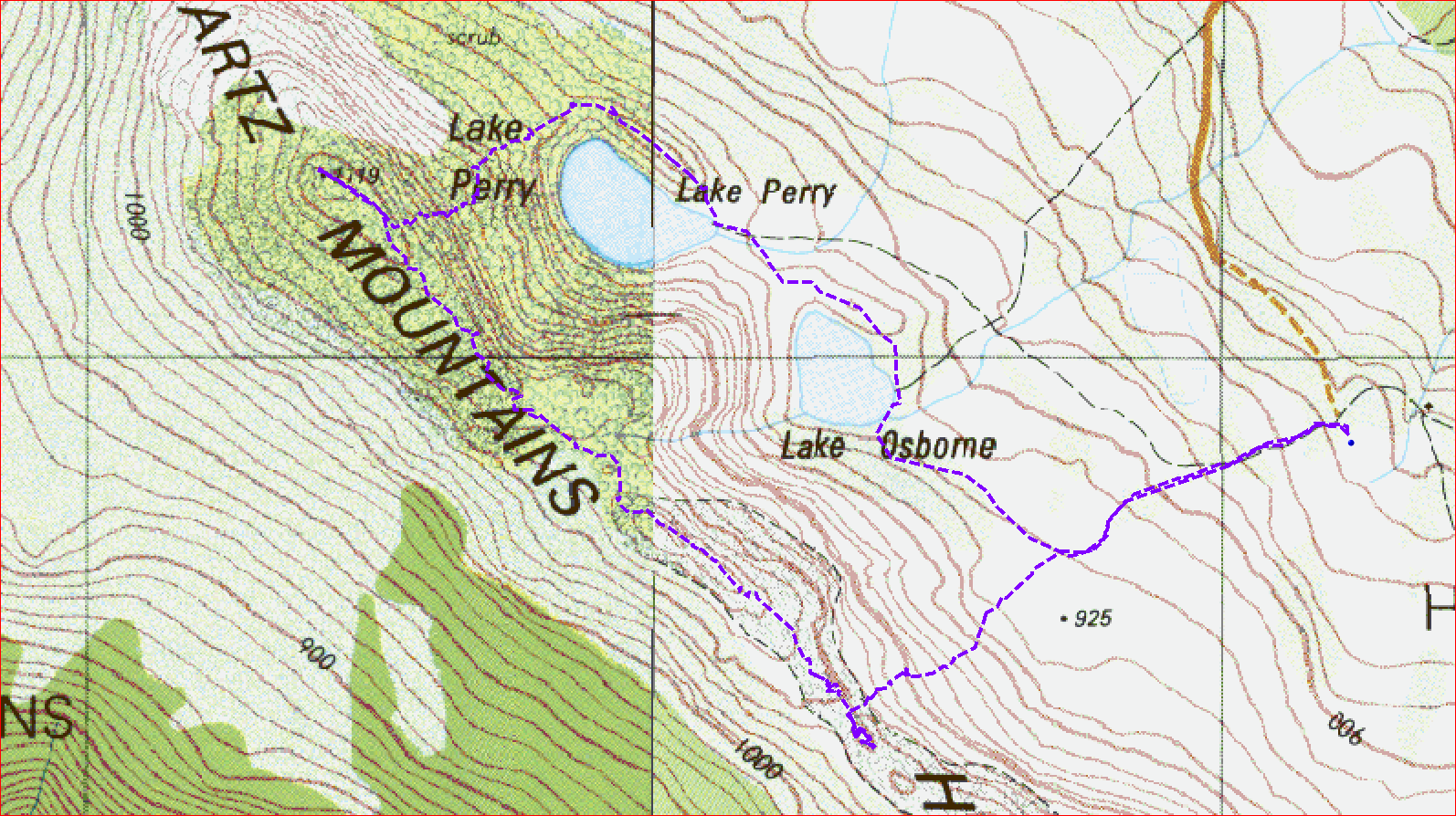
Sometimes walks don't go as planned and today was one of those. I had planned to walk from Hartz Mountains car park to Lake Perry, up to Devils Backbone along the ridge and back via the Hartz Peak track. It did not turn out quite like that as I had to cut the walk short.
I was the first car at the car park and set off up to Lake Osborne and then to Lake Perry. It was quite easy walking up until this point and a bit further up the ridge that headed up to Devils Backbone was okay as well with a pad to follow.
 |
| Lake Osborne |
 |
| Lake Perry |
 |
| Lake Perry |
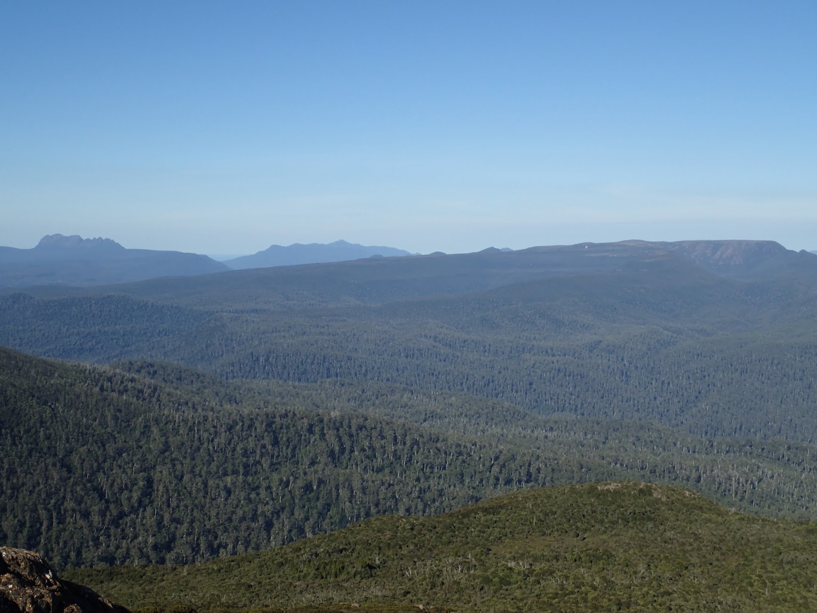
Soon the pad petered out or I failed to locate it, so I just went straight up towards the summit of the Backbone ridge. The scrub was quite bad in places and required some effort to break through, but eventually I came out on to the ridge line and walked up to the summit cairn on the right, about 200 metres from where I reached the top. This was very easy walking along here.
 |
| Northern section of Backbone |
 |
| From Summit |
 |
| Lake Perry from Summit |
 |
| Looking towards northern section |
 |
| From Summit |
 |
| Summit Cairn |
I then headed off along the ridge back towards Hartz Peak. There was a faint pad to follow and much was easy walking but there were a few scrubby sections and a few hills to climb. All was going well until I reached about the halfway point and I stepped in a hole with one foot and consequently smashed my knee on the other leg into a large rock. After initially recovering from the pain, I tried the knee out and it was a bit dicky, so rather than stress it out too much more, I decided to head down off the ridge to the Lake Osborne boardwalk, which I could see in the distance.
 |
| One of the rocky hills along the way |
 |
| Looking towards Hartz Peak |
 |
| The boardwalk in the distance |
This proved to be a good move because I found a great rock on which to stop and have lunch and rest up my knee. The descent to the boardwalk was a little scrubby in places but it did no take me too long to get down. after that it was just an amble or maybe that is hobble back to the car. The car park was full to overflowing and there were people everywhere.
This was a good walk(what I did of it anyway) and there is great scenery all along the Backbone on a clear day.
Distance: 6.4 kms.
Time: 5'04"
Ascent: 355 metres
Click here to download GPX file.


No comments :
Post a Comment