Friday 10th November 2017
 |
| Southport Lagoon |
The walk today was not supposed to be at Southport Lagoon. I had planned to do a circuit walk to Pebbly Beach and part of that walk would have been in the State Reserve and part in the Lagoon Conservation Area. This would have entailed walking along the Ida Bay Railway for part of the walk.
I parked near the Ida Bay Railway station as usual and was immediately challenged by a guy from the station who said that it was not a walking track along the railway line and I could not go there, even though there are National Parks signs indicating that it is indeed a walking track. There is some issue with a person injuring themselves and claiming compensation. Instead of getting into an argument, I decided to let it go and walk down to the Lagoon on the 4WD track.
I called in at the National Parks office in Huonville on the way home and I am waiting for clarification on the issue.
Note: Due to legal reasons it is now not permissible to walk down the railway line.
I set off up the road to the Lagoon Track and parked just at the start. I had not been on this track before, but from researching it, I knew it was supposed to be for high clearance 4WDs only, so I decided to walk it. I started walking and was waiting for it to deteriorate but it was a good road. I debated whether I should turn back and get the car but kept walking. That was a big mistake. The road was good and my standard clearance 4WD would have made it to the end of the road easily. The road is good enough to drive in about 2.0 kms. in a 2WD car and walk from there. When I did finally reach the beach there were a couple of guys just preparing to head out in their boat fishing and they only had standard clearance vehicles.


The walk in on the road is about 6.0 kms. and is pretty boring as is most road walking. When I reached the beach I set off in a northerly direction around the coast. It was a little muddy in places but easy walking. I soon came to a creek and instead of walking upstream to find a crossing, I just waded across. It was only knee deep.
 |
| Island of no name |
 |
| Creek |
 |
| Creek Crossing |
I kept going around the coast and had to walk in the water a various places but it was not deep. There were a few sandstone formations but nothing spectacular.
I could hear the fishermen celebrating so they were obviously catching something. They were chasing flathead, they told me. I carried on to a point were I thought I had probably walked enough, being mindful that I had to walk back.
After and early lunch I started heading back, but headed inland where I knew there were button grass plains, which usually provide reasonable walking. This proved to be the case and I also had beeter views of the lagoon from up slightly higher.
This was not a bad walk despite the 12.0 kms. of road walking and if I come this way again, I will know that I can drive all the way in and then probably walk over the other side to Lagoon Beach.
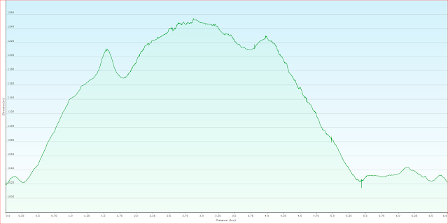
Distance: 17.3 kms.
Time: 5"30"
Ascent: 400 metres
Click here to download GPX file.


