Pages

Saturday, 3 September 2016

Mount Snowy

Saturday 3rd September 2016

Mount Snowy
The last time I attempted this walk the weather became particularly unfriendly with whiteout conditions, driving rain and a gale blowing, not to mention that it was freezing as well. On that occasion I only walked to the saddle between Hartz Peak and Mount Snowy and returned via Emily and Arthur Tarns, abandoning any attempt of going to the summit of Mount Snowy. Today the weather was great and I completed the circuit and was treated to fantastic views.
I set out from the car park quite early...in fact I was the only one there, and walked up to Hartz Peak first. There was some snow at Hartz Pass and it was not easy to cross as it was very firm and slippery, but I made it okay.
Devils Backbone

Hartz Peak

Mount Snowy and Hartz Peak

Mount Snowy

Hartz Pass

Hartz Pass
There were great views of snow capped mountains to the west and south west.


Hartz Peak

Emily Tarn

Hartz Lake


I didn't hang around on Hartz Peak for too long and set off for Mount Snowy. The track basically goes along the western side of the ridge just below the ridge line. There really is no track, just an occasional cairn, so it is just as easy to find your own way while looking for bits of track here and there. The descent off Hartz Peak was a little tricky due to the frosty rocks but I made it without slipping over. It took about 40" to walk along the ridge before descending to the saddle.


Along the ridge

Mount Snowy
Hartz Peak from the saddle
I crossed the saddle and climbed up to the summit of Mount Snowy which did not take too long. The views from up here were great also.

Hartz Peak from Mount Snowy ascent

Esperance and Adamsons Peaks

Towards Bruny Island

Mount Snowy summit
I reclined in the little summit shelter and had an early lunch before descending to the saddle and picking up the track past the tarns. The track was quite wet in places but quite easily followed although it is overgrown in a few patches. As I was passing Emily Tarn I could hear voices coming from Hartz Peak, and sure enough there were some people up there.

Emily Tarn

Hartz Peak from Emily Tarn

Emily Tarn

Arthur Tarn

Arthur Tarn
This is a great walk with excellent views but make certain to choose a fine and clear day to take full advantage of the scenery.
Distance: 10.6 kms.
Time: 5'08"
Ascent: 640 metres
Click here to download GPX file.


Sunday, 21 August 2016

Denison Hill

Sunday 21st August 2016

Denison Hill
After walking Denison Hill about 4 months ago I thought it was worth another visit to explore some of the other tracks in the area.
We set off from the same car park and climbed up the track to the top of Denison Hill. Just after the start we spied this quaint dunny just off the track and in the bush which I had not noticed before. Obviously it had been there for quite some time.

Dunny

Track heading up to Denison Hill

Track across top of Denison Hill
Once we reached the top of the hill we kept walking straight ahead and came to a recently clear felled area. We had to walk around many logs that had been placed on the track. After passing this area the track continued downhill. A tracked vehicle had come up here to do the felling and it was very slippery from where it had disturbed the ground. Eventually we reached the good road at the quarry site.

Looking across to the other side of the Huon River
We then walked down a track heading south and found a old track that headed towards the river. This track was somewhat overgrown but fairly easy to follow and we soon reached the river. The track then headed along the river bank all the way to the junction of the Little Denison and Huon Rivers.
We stopped at a nice spot above some rapids for a snack.

Huon River

Huon River

Wetland near mouth of Little Denison River
Huon River
Little Denison River

Mouth of Little Denison River
There was much more water in both rivers today than there was last time I was here. After looking around we walked up beside the Little Denison to the great spot where there is a large expanse of flat rock.

Denison Hill

Little Denison River

Little Denison River

Little Denison River
From here we walked backed through the eucalyptus plantation and to the good road. The wild flowers were starting to bloom.

Wild flowers
The walk continued on the good road for a time before I located the old track that I wanted and we set off up the hill. It started out okay but soon just became an animal pad where some scrub bashing was required. We eventually made it up to more level ground where the track improved somewhat. I think it proved a better alternative than trying to slog up the slippery track that we had come down.

Looking across to the other side of the Huon River
Soon we reached the outward leg of the track and followed it back to the car.
A nice walk with good river views.
Distance: 13.6 kms.
Time: 5'29"
Ascent: 540 metres
Click here to download GPX file.


Monday, 15 August 2016

Victors Garden

Monday 15th August 2016

Part of rock wall at Victors Garden
I wanted to walk some of the tracks and trails in the Glenorchy Water Reserve and Wildlife Sanctuary and decided to make Victors Garden the destination to make the walk a reasonable distance. Of course, Victors Garden can be reached via a shorter route from the end of Lenah Valley Road.
I parked outside of The Riding for Disabled establishment on Kalang Avenue, crossed the road and walked up a track beside Barossa Creek and then came to a cleared area. Motor bikes have been extremely active in this area even though the signs say it is not allowed and have used the cleared area for a hill climb.
Track beside Barossa Creek

Motor bike tracks

Wattle trees in bloom

Cleared area
Once I reached the top of the hill I was on the Priest Fire Trail and followed this until it met the Merton Fire Trail. I walked this trail around the side of the ridge before I came to and old overgrown track that headed up to the top of the ridge. It started out okay but nearer the top it became nothing more than a goat track but still easy to follow. I eventually met the Priest Fire Trail again where there was a structure used by cyclists, I think.
Limekiln Gully and Lower Glenorchy Reservoirs


I continued on down the Kangaroo Fire Trail and somehow ended up on the North South Track. I must have been daydreaming at this stage because this was not where I wanted to go. After walking about 500 metres down this track, I realised the error of my ways and backtracked to a point where I could access the trail I wanted. Once on the right track I carried on up hill until the old track ended.

North South Track

Old track heading up to Victors Garden
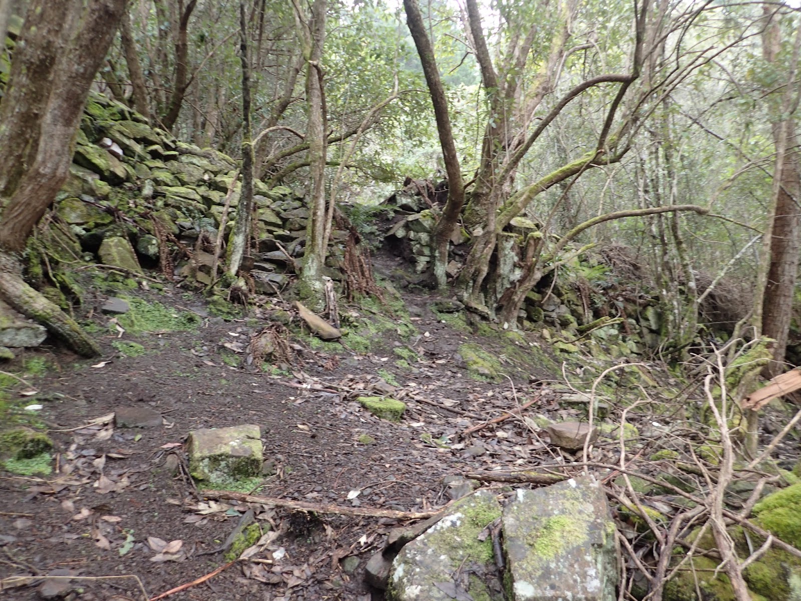
The foot track to Victors Garden headed up a couple of hundred metres to where Victors Garden and Hut once stood. All that remains now are a large expanse of walls and terraces, a little of a hut and some exotic plants including large pine trees. I spent some time looking around.

Rock wall

Rock wall

Some relics

Possible hut remains

Stone steps

Exotic plant

Waterhole
Exotic plant

Exotic plant
After getting a little wet from the drizzly rain I head back down and once I hit the Priest Fire Trail I followed this around to where it met the Merton Trail. I was going to walk downhill through the scrub but spotted a well used walking/bike track that appeared to head in about the right direction. It went around the contour before meeting an old track which headed down to Barossa Creek and the Kalang Fire Trail. I followed this for a while and then diverted off on another track which eventually came out on Kalang Avenue and the car.
This was a good easy walk mostly on fire trails and old tracks.
Distance: 12.2 kms.
Time: 4'09"
Ascent: 730 metres
Click here to download GPX file.


The following is an extract from the Wellington Park Management Trust report on the site and is all anecdotal information.

Victor built the main hut soon after the 1967 bushfires. All the building materials needed to be carted in. The main hut was constructed from stone. It had two stories and a corrugated iron roof. The hut was located on one of the 4-5 terraces constructed on the side of the mountain. At the end of the terrace was a lean-to workshop. On the same level was a bunk-house built on stilts and painted to blend in with the trees. In late 1960s - early 1970s the place had one cultivated terrace, a row of small pines, 2 bee hives, a gate, a benched track and a 'man-made waterhole'. A visitors book was kept at the hut and the place was known to some bushwalkers as 'Xanadu'. The origin of the clearing and use of the area is unknown. Some reports suggest the area had some development prior to the 1960s and that is that the area was first established during or immediately after WWII by a sect but was abandoned well before Victorbuilt his house there. The Temple was burned down in 1984 and a
second hut was built by Victor approx 500m from The Temple. Around 1988 Victor is said to have become a priest and returned to Ukraine.