Pages

Thursday, 3 November 2016

Mount Nelson

Thursday 3rd November 2016

Mount Nelson Signal Station
Mount Nelson has a myriad of tracks and is just a stones throw from the centre of Hobart so it provides options for plenty of shorter walks.
I started today's walk from Lambert Avenue and walked up beside Lambert Rivulet and then headed west over to Nelson Road.
Track near start

Lambert Rivulet

Lambert Rivulet

Track up further

Lambert Rivulet

Lambert Rivulet
Once on Nelson Road I followed it for a short distance before once more entering the park and then across private land where the owners have given permission to walk along the track. There were good views of the city along here.

Hobart
When the track started heading north towards the reserve I began to cross what appeared to be a construction site with a few buildings in various stages of construction. It was not until I reached the other side did I come across a "no entry construction site" sign. It may be best to try to avoid this section of the track. A track turns off to the left before coming to this section and heads north up to the reserve. Once in the reserve I carried on up to Mount Nelson.

Mount Nelson

Mount Nelson

Mount Nelson

Mount Nelson
As usual there were great views from the summit as the skies were fairly clear. From here I walked in a easterly direction along an old track and then a walking track down to the Truganini track. It was quite steep and moist along here. Once I reached the Truganini track I saw a sign that said the track I had been on was private property but going by the amount of traffic that it carries, I would say that most people ignore that sign. The track is marked on the LISTmaps site as a walking track.

Large cairn where the walking track branches off the vehicle track

Resident Pademelon

Track heading down to Truganini
The Truganini track followed up beside Cartwright Creek and up to Mount Nelson. It was also quite wet and muddy in places.

Cartwright Creek

Truganini track

Cartwright Creek
From Mount Nelson I just walked on the normal track that goes back down to Lambert Avenue and the car.
This was a good short walk with some nice scenery and forest close to Hobart.
Distance: 11.6 kms.
Time: 3'28" Ascent: 720 metres
Click here to download GPX file.


Thursday, 20 October 2016

Lake Webster Circuit

Thursday 20th October 2016

Unnamed peak behind Lake Webster
The aim of today's walk was to do a circuit walk starting at Lake Fenton, up the road to Lake Dobson, along the track to Lake Webster and then back to the car via the Lake Fenton track. Of course it would be easier to have a car at Lake Fenton and one at Lake Dobson to avoid the road walk, but actually it was great scenery as I walked along with all the mountains having a covering of snow. It was only 3.5 kms. between the two lakes and it only took 45" to walk it. I decided to get the road walk over early to avoid having to walk it when there would be much more traffic as normally happens later in the day.
I set off along the short track to the road and then up the road to Lake Dobson. An easy stroll with great scenery.

Start of walk

Roadway

Beside road

Rodway Range

Mawson Plateau

Mawson and Rodway

Mawson Plateau, Rodway Range, Mount Bridges
I was pleasantly surprised by the amount snow around and once I reached Lake Dobson I opted for the Pandani walk around the lake which is always nice.

Lake Dobson

Track around Lake Dobson

Pandani walk

Pandani

Eagle Tarn
I soon passed Eagle Tarn and onto the ski road and finally on to the track to Lake Webster. There were no footprints here so no one had been along it for a few days.

Road to ski lodges

Some little critter had been along here

Start of Lake Webster track

Lake Webster track and my boot prints
Rodway Range and Mount Bridges
The track was easy to follow even though it was covered in snow and I soon reached the turnoff for the Lake Fenton track. The snow did decrease once I reached lower elevation at Lake Webster as one would expect. I knew the next obstacle was going to be the crossing of the Broad River. As expected the level was up from the recent rain and there was no way to get across without either wet feet or wet boots. I opted for wet feet as I hate walking in soggy boots. There was a log spanning the river but there was no way I was going across that as it was so slippery. After a snack I removed my boots and socks and waded across. It was only knee deep in one place. The water was so cold, it was painful...and I mean extremely painful. After drying off my feet I rebooted and headed off towards Lake Fenton.

Broad River

Broad River

Broad River Crossing
 The track meandered up to Kangaroo Moor which is a pleasant area and where I had my first view of Lake Fenton.

Lake Fenton track


Kangaroo Moor

Kangaroo Moor and Lake Fenton
The track skirted around the lake and came quite close to it in places.

Lake Fenton
It did not take too long to reach the outflow of Lake Fenton and here there was a reasonable amount of water coming over the spillway mainly being caused by the strong wind that was blowing. From here it was just a short amble back to the car.

Lake Fenton outflow

Lake Fenton
A really nice short walk with lovely wintry scenery and even shorter with two cars.
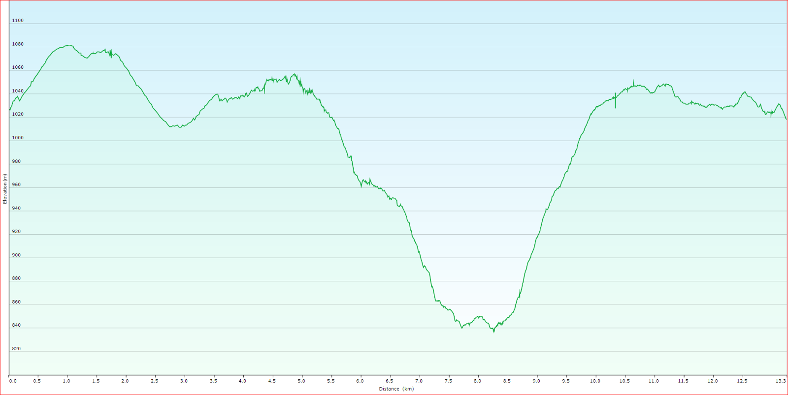
Distance: 13.3 kms.
Time: 4'20"
Ascent: 400 metres
Click here to download GPX file.